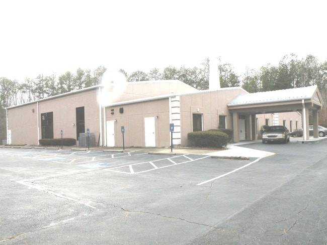
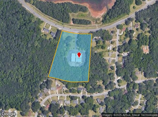
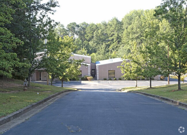
Property Record
4644 Campbellton Rd Sw, Atlanta, GA 30331

NEARBY LISTINGS FOR SALE OR LEASE
Property Detail
4644 Campbellton Rd Sw
14F-0065-LL-093-3
CHURCH EXEMPT FOR TAX YR 2018
Religious
Fulton
X
Georgia
13121C0333F
65
2024
6.06 AC
2025
North Clayton/Airport
010305
Atlanta
11,670 SF
Atlanta-Sandy Springs-Roswell, GA
DEMOGRAPHICS near 4644 Campbellton Rd Sw
1 Mile
3 Mile
5 Mile
2024 Total Population
4,786
42,158
121,988
2029 Population
4,938
43,255
125,920
Pop Growth 2024-2029
+ 3.18%
+ 2.60%
+ 3.22%
Average Age
43
40
39
2024 Total Households
1,771
17,386
48,703
HH Growth 2024-2029
+ 3.27%
+ 2.63%
+ 3.27%
Median Household Inc
$74,540
$68,903
$63,925
Avg Household Size
2.60
2.40
2.40
2024 Avg HH Vehicles
2.00
2.00
2.00
Median Home Value
$210,177
$277,549
$267,658
Median Year Built
1979
1993
1987
Nearby Places
Map Layers
Map Styles
 Street
 Aerial
- Restaurants
- Banks
- Shops
- Fitness
- Groceries
PUBLIC TRANSPORTATION
AIRPORT
Hartsfield - Jackson Atlanta International
DRIVE
WALK
Distance
Hartsfield - Jackson Atlanta International
22 min
13.3 mi
SALE & LEASE HISTORY
LISTING DATE
SALE/LEASE

Sep 24, 2016
For Sale
Nearby Properties
Address
Land Use
TOTAL SIZE
Lot Size
Zoning
Address
Land Use
TOTAL SIZE
Lot Size
Zoning
312,984 SF
19.88 AC
Address
Land Use
TOTAL SIZE
Lot Size
Zoning
356,458 SF
18.72 AC
PDMU
Address
Land Use
TOTAL SIZE
Lot Size
Zoning
802,908 SF
18.26 AC
RG3
Address
Land Use
TOTAL SIZE
Lot Size
Zoning
830,966 SF
23 AC
MIXU
Address
Land Use
TOTAL SIZE
Lot Size
Zoning
1,045,610 SF
110.63 AC
SUBA
Address
Land Use
TOTAL SIZE
Lot Size
Zoning
5,459 SF
12.97 AC
C1
Address
Land Use
TOTAL SIZE
Lot Size
Zoning
282,610 SF
11.20 AC
C1
Address
Land Use
TOTAL SIZE
Lot Size
Zoning
364,391 SF
25.33 AC
R4
Address
Land Use
TOTAL SIZE
Lot Size
Zoning
135,211 SF
51.76 AC
OI
Address
Land Use
TOTAL SIZE
Lot Size
Zoning
274,956 SF
74.20 AC
AG1
Address
Land Use
TOTAL SIZE
Lot Size
Zoning
3,289,702 SF
16.23 AC
C1C
Address
Land Use
TOTAL SIZE
Lot Size
Zoning
42.90 AC
R4
Address
Land Use
TOTAL SIZE
Lot Size
Zoning
395,218 SF
21.61 AC
A1
Address
Land Use
TOTAL SIZE
Lot Size
Zoning
1,994,368 SF
17.10 AC
ACOND
Address
Land Use
TOTAL SIZE
Lot Size
Zoning
1,333,625 SF
15.28 AC
A1
Address
Land Use
TOTAL SIZE
Lot Size
Zoning
2,002,026 SF
17.51 AC
RLC
Address
Land Use
TOTAL SIZE
Lot Size
Zoning
9,590,784 SF
27.23 AC
RG3
Address
Land Use
TOTAL SIZE
Lot Size
Zoning
764,659 SF
51.57 AC
C1
Address
Land Use
TOTAL SIZE
Lot Size
Zoning
5,238,150 SF
24.10 AC
R3C
Address
Land Use
TOTAL SIZE
Lot Size
Zoning
545,000 SF
31.57 AC
M1A
Address
Land Use
TOTAL SIZE
Lot Size
Zoning
1,715,322 SF
18.09 AC
A1
Address
Land Use
TOTAL SIZE
Lot Size
Zoning
252,378 SF
19.20 AC
MIAC
Address
Land Use
TOTAL SIZE
Lot Size
Zoning
327,763 SF
25.80 AC
MIAC
Address
Land Use
TOTAL SIZE
Lot Size
Zoning
280,855 SF
17.13 AC
MIAC
Address
Land Use
TOTAL SIZE
Lot Size
Zoning
206,708 SF
5.75 AC
C1C
Address
Land Use
TOTAL SIZE
Lot Size
Zoning
575,712 SF
3.29 AC
C1
Address
Land Use
TOTAL SIZE
Lot Size
Zoning
272,400 SF
25.48 AC
MIAC
Address
Land Use
TOTAL SIZE
Lot Size
Zoning
35,542 SF
405.72 AC
AC
Address
Land Use
TOTAL SIZE
Lot Size
Zoning
16.76 AC
R4
Address
Land Use
TOTAL SIZE
Lot Size
Zoning
22.73 AC
The World's #1 Commercial Real Estate Marketplace
Connect with us
© 2025 CoStar Group
The information above has been obtained from sources believed reliable. While we do not doubt its accuracy we have not verified it and make no guarantee, warranty or representation about it. It is your responsibility to independently confirm its accuracy and completeness. Any projections, opinions, assumptions, or estimates used are for example only and do not represent the current or future performance of the property. The value of this transaction to you depends on tax and other factors which should be evaluated by your tax, financial, and legal advisors. You and your advisors should conduct a careful, independent investigation of the property to determine to your satisfaction the suitability of the property for your needs.